
For three days, Raphaël and Olivier decided to hike around a small group of moutains, north-west of SkydKap, and to climb up the 1376m high local highest peak : The Pythagoras.
The two last days of the adventure, a tale by Raphaël.
After a tough day, punctuated by a night finally good enough, we take the walk along the lake. The path is through a steep landslide with large blocks occupy the entire shore and hide the rest of the route, which makes walking painful.
We spend the last cap stones and landscape changes completely everything: lush tundra and azure Nordvestfjord succeed to the gray lake and rock. It seems to have reached a little piece of paradiseAfter the hell of scree ... As Olivier had hoped, an online obvious ascent before us: mounted on a mound full of vegetation and growth in a scree and unstable rise of a corridor where we will have to use hands.
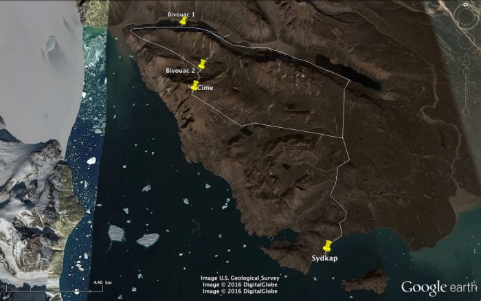 The map of the path traveled by Raphael and Olivier.
We realize this ascent with extreme cautionDespite the lack of time. Indeed, we should hurry up to the challenge to make this adventure in two and a half days, knowing that we have provided food for the duration. We move slowly anyway because "a key parameter forces us The lack of available aid, to more than one camp day walking and no means of communication. So no madness is permitted.
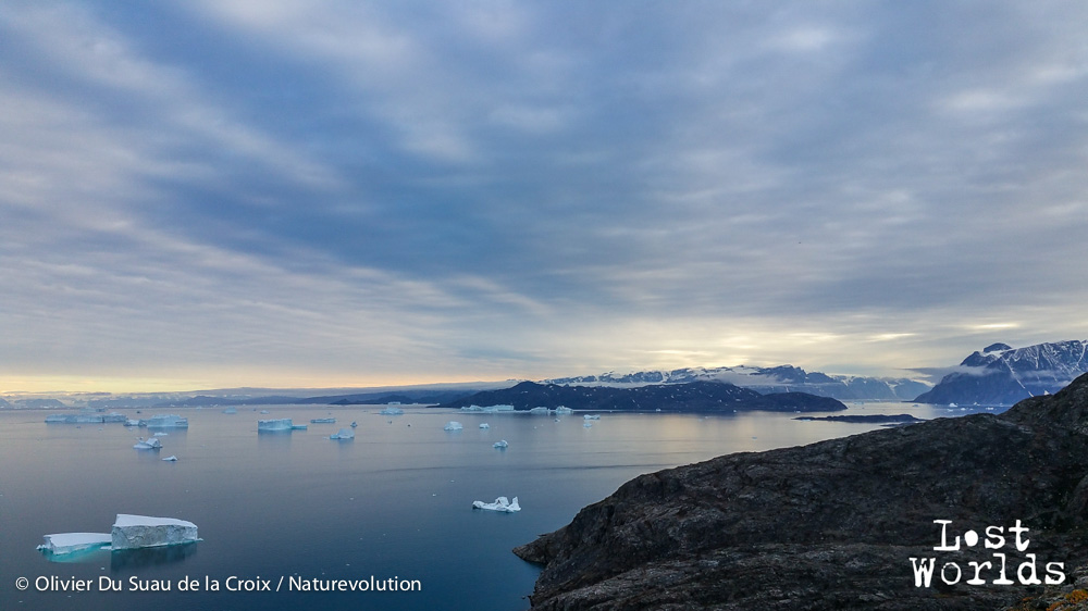
View of the Bear Islands and Renland right above Sydkap.
However, we do not hesitate to commit ourselves to achieve our goals: le tour et la cime de ce petit massif. Les discussions cessent alors, chacun prend ses distances pour éviter de blesser l’autre en faisant chuter des pierres ; nous nous concentrons sur chaque pas, chaque prise.
Arrivés au sommet du passage, nous entrons dans un autre monde, plus froid et plus sombre que le long du lac, mais offrant une vue nettement plus dégagée : un plateau ondulé et encadré de montagnes.
Nous profitons quelques instants des derniers rayons de soleil de ce 1er septembre puis filons vers la succession de lacs qui mènent à la base du Pythagoras, notre objectif. En cette fin de journée, je ressens fortement les effets de la fatigue couplée au manque de sucre : several times, I have to stop drinking and wait for my view is more troubled. We drive up to the third lake that we see, just as Pythagoras.
As to reach the plateau, Olivier quickly finds a clear path and the joint decision to borrow is taken We go so well at the top, after some doubts, some moments of discouragement. We enjoy a meager dinner, taken from the tent, sleeping bags, then we are sinking fast.
Our rude awakening: a strong wind rises around 5 am, but we are extending the night until 6 am, as we planned. At 7:20 everything is folded.
The ascent follows is rude : Wind, cold, rickety scree, icy snowfields, steep path which is difficult to see the end. We do not go the natural route, of course, we are probably the first to go down this line of ascentAnd even this face. But we have no choice: not enough time to go around the mountain and attack by his weak point. We prefer the climb in a little obvious area which offers the shortest path to our Sydkap camp.
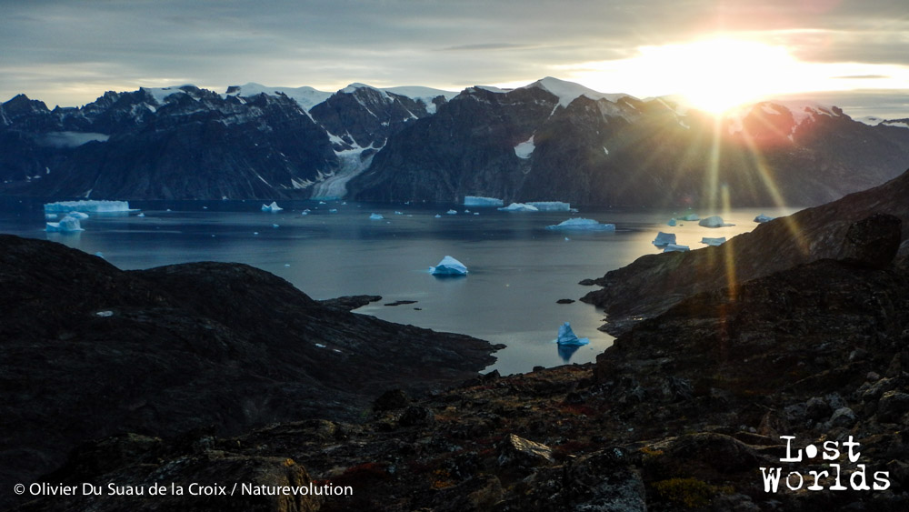 The sun sets behind the peaks of Renland by throwing its last rays on icebergs Nordvestfjord.
Near the summit, shortly before 10 am, je crois avoir eu le plus froid de toute l’expédition, malgré le soleil. Le vent est violent et il n’y a plus que de la neige, alors qu’on a tout juste dépassé les 1000 mètres d’altitude : on a parfois tendance à oublier qu’on est au Groenland !
Au sommet, nous ne restons que quelques instants. La vue est évidemment à couper le souffle ! La descente se fait ensuite par étape : dans la neige, puis dans un pierrier et enfin sur le plateau, mais de l’autre côté du sommet. Ce long plateau que nous avions parcouru le premier jour.
Nous prenons nos distances avec Olivier : celui-ci rentre directement au camp, pendant que je fais une pause dans un écrin de verdure, à proximité d’un torrent puis reprend la marche en direction de notre confortable cabane.